
I’m way behind on plugging this, but much thanks to Martin Matthews and Ansible for publishing my short horror story, “Melt.” The melting snows of spring aren’t always a good thing…
You can read it in full here.

I’m way behind on plugging this, but much thanks to Martin Matthews and Ansible for publishing my short horror story, “Melt.” The melting snows of spring aren’t always a good thing…
You can read it in full here.
Location: Jackson, NH
Date: 7/15/23
A couple of shots from Glen Ellis Falls. Nice short hike down to the falls, although you will run into a fair amount of stairs if you wish to get to the bottom of the falls (highly recommended, if only for the mist factor).
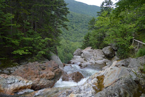
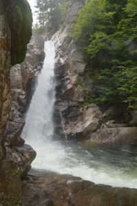
Feel free to share or use these pictures for personal use, so long as you link back to this site. Thanks!
 (HoratianTimes.com) Shortly after news broke that Trump aides were seen moving boxes at Mar-a-Lago a day before the DOJ showed up searching for top secret documents, another informant surfaced with information that could put ex-President Trump in even further legal peril.
And this time, calligraphy pens were involved.
A groundskeeper has told authorities that in the month leading up to the DOJ raid, two dozen Hassidic scribes were seen frequently entering the Mar-a-Lago compound around dawn and not leaving until well after dark.
“24, 25 of them easily, I think,” the groundskeeper said. “They go it, hands clean. They come out, hands black with ink. And very tired.
“For a month they do this, maybe more. It was strange, even for Florida,” the groundskeeper said.
-You can read the complete article at:
https://horatiantimes.com/satire/trumps-secret-document-mess-gets-a-little-prettier/
 (HoratianTimes.com) When news broke earlier this week that former America’s Mayor Rudy Giuliani was being sued for sexual assault and harassment, one of the claims that surfaced was that both he and former-President Trump had engaged in a plot to charge $2 million for pardons.
What was not commonly reported, however, was that this was merely the tip of the iceberg when it came to the two men’s plans to milk the waning days of the administration for cash.
“A lot of the people who approached us, they had been through some things. Bad, bad things,” said one of Giuliani’s top aides at the time. “You’re in jail, or have had to pay huge fines… You don’t have $2 million kicking around, you know? But I bet you have a little something tucked away, and we were always willing to deal.”
-You can read the complete article at:
https://horatiantimes.com/satire/2-million-pardons-were-but-one-element-of-trump-administration-fire-sale/
 (HoratianTimes.com) Amidst the indictments and murders and muggings and firings and wildfires and arrests and accidental racism and sports highlights and celebrity gossip, a truly profound event happened last month that went almost unnoticed by the press.
Unnoticed, that is, except for Buck Bomhower, editor of the Better Bunker Times.
“We usually do a ‘mass murder of the day’ feature on our website, highlighting the previous day’s mass shootings, mass vehicular homicides, mass chainsawings, that sort of thing,” Editor Buck said. “It’s not to glamorize it or anything, mind you, but more to point out how dangerous these times are.
“Dangerous to the point where you should be constantly bulk buying guns, ammo, shelf-stable foods, and other prepper equipment. All of which are available on BetterBunkerTimes.com. Mention Bucky sent you and get 10% off our Zombie Napalm, all sizes!”
“So anyways, I get to 4/20/23 and start looking through the news, and I go ‘huh’. There weren’t no mass murderings on 4/19/23. Not a one. Tell me that’s not weird,” Editor Buck said.
-You can read the complete article at:
http://horatiantimes.com/satire/mass-shootings-take-a-day-off-stun-america/
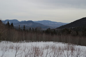
Location: Hart’s Location, New Hampshire
Date: 02/17/23
50 degrees mid-February? Yeah, that is definitely hiking weather. First picture is from the summit, second from the scenic overlook outside the entrance to the Mt. Washington Omni (was going to pass it by, but the mountain was looking it’s best after setting records a couple of weeks ago). The third is stitched together from a few shots on the summit. Not great due to the sun, but still an impressive sight once you get up there.
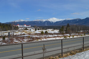
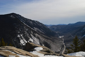
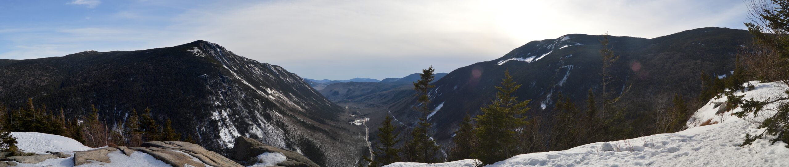 (click on this for full size)
Feel free to share or use these pictures for personal use, so long as you link back to this site. Thanks!
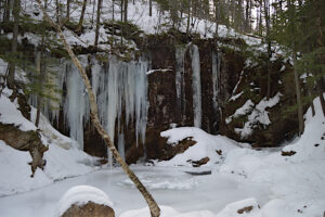
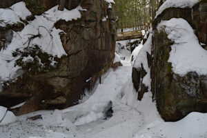
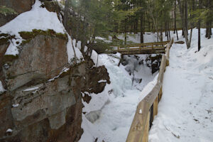
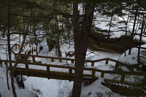
Location: Sabbaday Falls, Kancamagus Highway, White Mountains, NH (Albany, NH)
Date: 02/05/23
Sabbaday Falls on the Kancamagus Highway (and one of the Pemigewasset Overlook). Glad we held off a day. ![]() Around 20 degrees, which puts it 30-40 degrees warmer than it was yesterday.
Around 20 degrees, which puts it 30-40 degrees warmer than it was yesterday.
Feel free to share or use these pictures for personal use, so long as you link back to this site. Thanks!
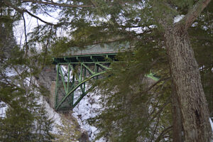
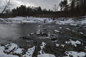
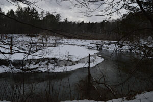
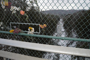
Location: Quechee, Vermont
Date: 01/31/23
This certainly isn’t a long or arduous hike: maybe a mile overall, more if you explore some of the other trails here. The hike down to the bottom of the gorge is around a half-mile, and just over 150 feet down. The trail runs along the river, and there is a fence protecting you from a fall (which will likely be lethal). Well traveled on weekends in the winter (I would imagine… I had the place to myself on a Tuesday, but it was cold), and pretty icy.
Feel free to share or use these pictures for personal use, so long as you link back to this site. Thanks!
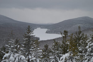
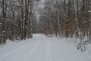
Location: Peacham, Vermont
Date: 01/24/23
First real snow of the season, in the form of three storms over the course of a week. This was shortly after the second, which dumped around 10 inches in the area.
Feel free to share or use these pictures for personal use, so long as you link back to this site. Thanks!

Powered by WordPress & Theme by Anders Norén